Video file
TRANSYLVANIA COUNTY RESOURCES FOR 2025 WILDFIRES
IMPORTANT LINKS
Emergency Management 101 for Citizens
CLICK HERE TO SIGNUP FOR EMERGENCY ALERTS
Need Help Signing Up: Click Here for instruction guide.
Video file
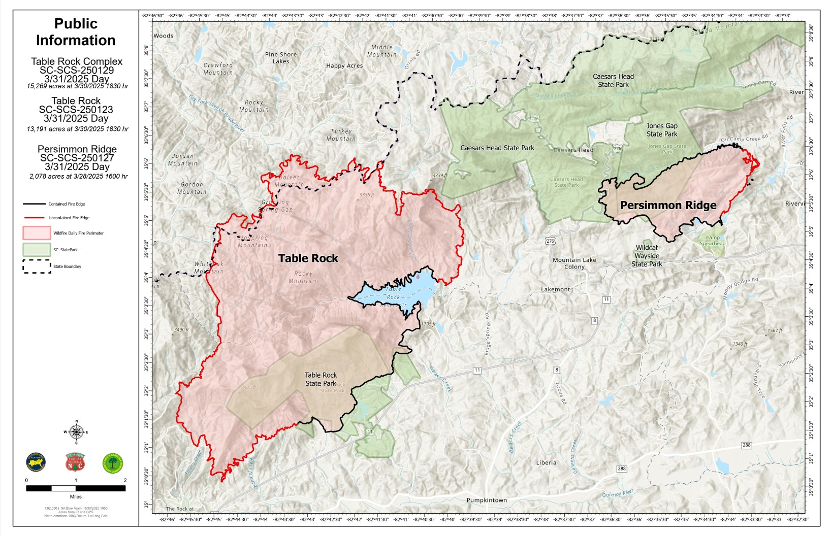
After consultation with the Table Rock Complex Fire Blue Team command, Transylvania County is lifting the yellow zone. Please avoid travel in the area for now as there will continue to be firefighters and equipment still moving through the area as the team continues to move towards containment of the fire.
There are no current evacuation orders in Transylvania County, NC
This map will be updated as evacuation areas change.
INFORMATION
Declaration of a Local State of Emergency
Transylvania County Facebook Page
Transylvania Emergency Services Facebook Page
Transylvania County Sheriff's Office
South Carolina Forestry Commission
North Carolina Emergency Management
Connestee Fire Rescue Facebook
Cedar Mountain Fire Rescue Inc. Facebook
PRESS BRIEFINGS
March 28th Press Briefing 11AM
March 28th Press Briefing 6 PM
March 29th Press Briefing 9:30 AM
March 29th Press Briefing @ 12 PM
March 29th Press Briefing @ 6 PM
March 30th Press Briefing @ 9:30 AM
March 30th Press Briefing @ 12 PM
March 30th Press Briefing @ 3 PM Fire Evacuations are Lifted Effective Immediately
March 30th Press Briefing @ 8:30 PM
*Reports will be issued two times per day effective March 31st.
March 31st Press Briefing @ 1:30 PM
March 31st Press Briefing @ 6PM
April 1st Press Briefing @ 6 PM
April 2nd Press Briefing @ 6 PM
April 3rd Press Briefing @ 6 PM
TABLE ROCK OPERATIONAL MAPS
RATTLESNAKE BRANCH OPERATIONAL MAPS